Monday, November 07, 2005

So here you go. This blog has taken fourteen days to put up, two days more than it took us to climb up to the Gokyo lakes and back. But it was fun, because it entailed reliving the trip of a lifetime. I only hope you have as much fun going through it.
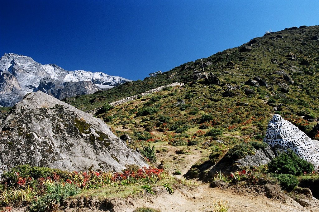
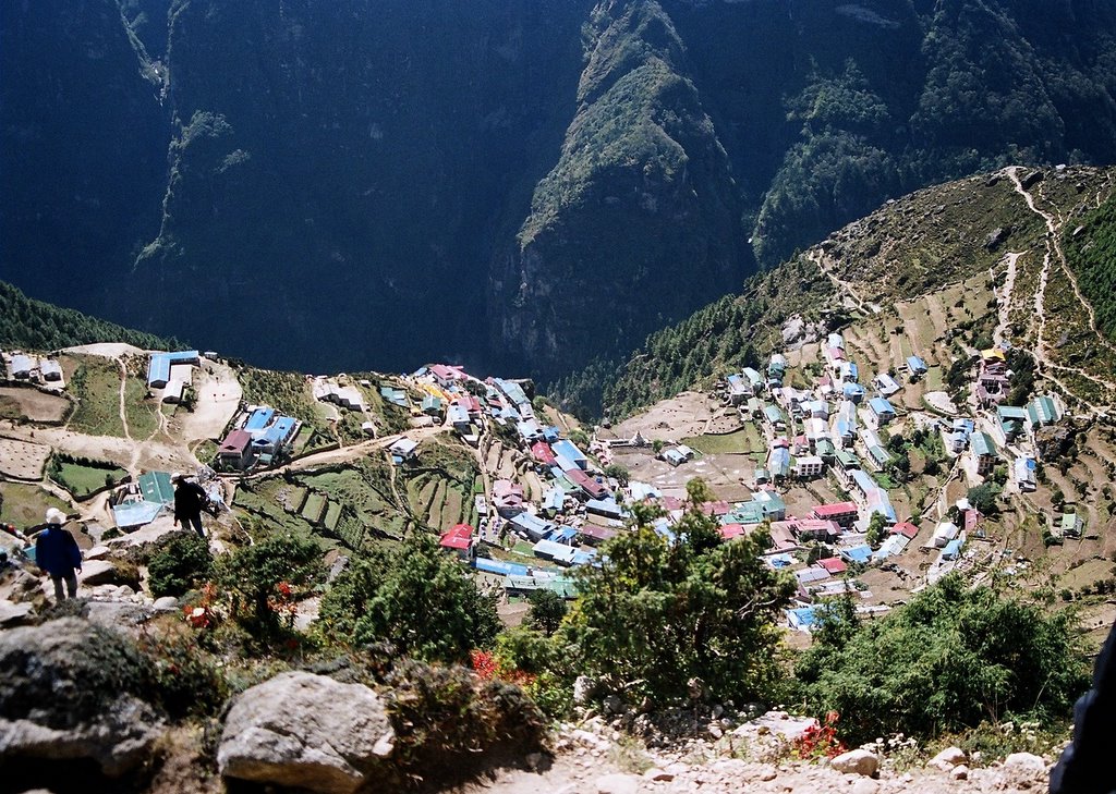
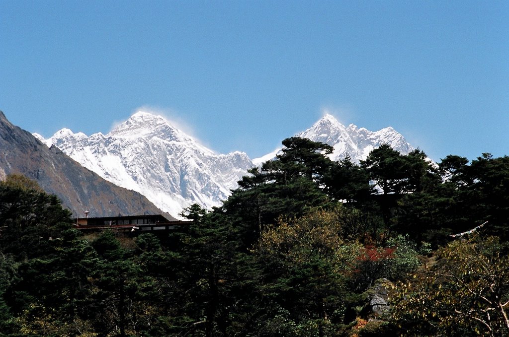
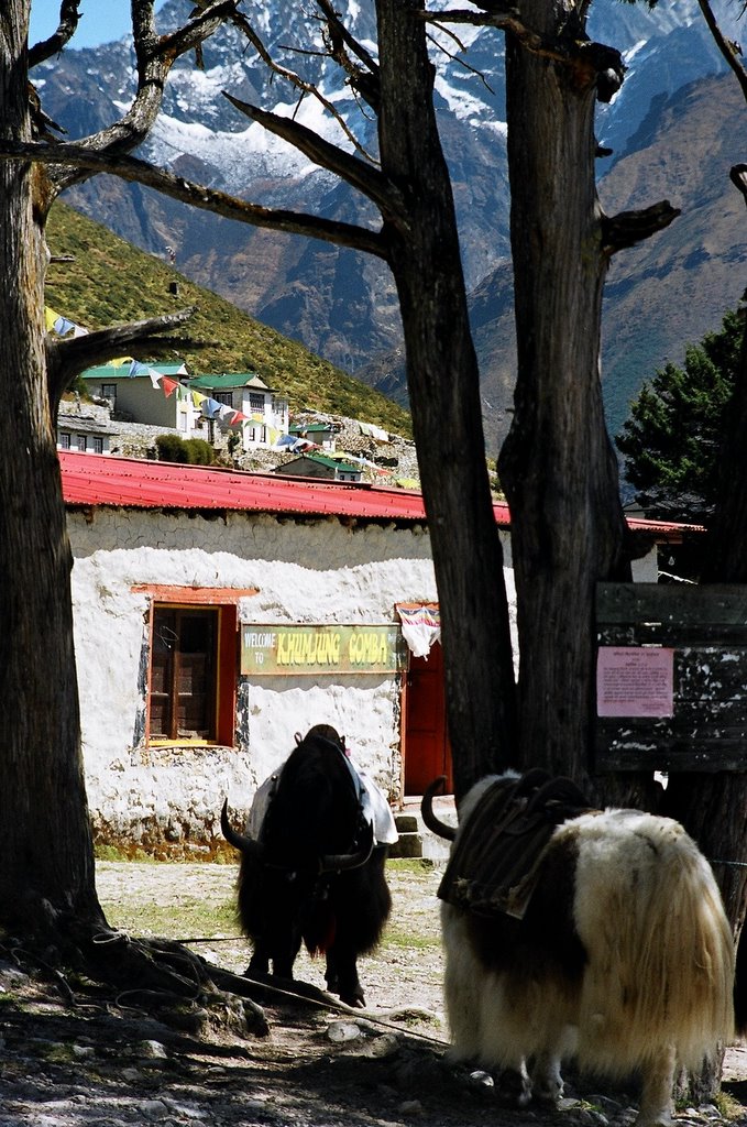
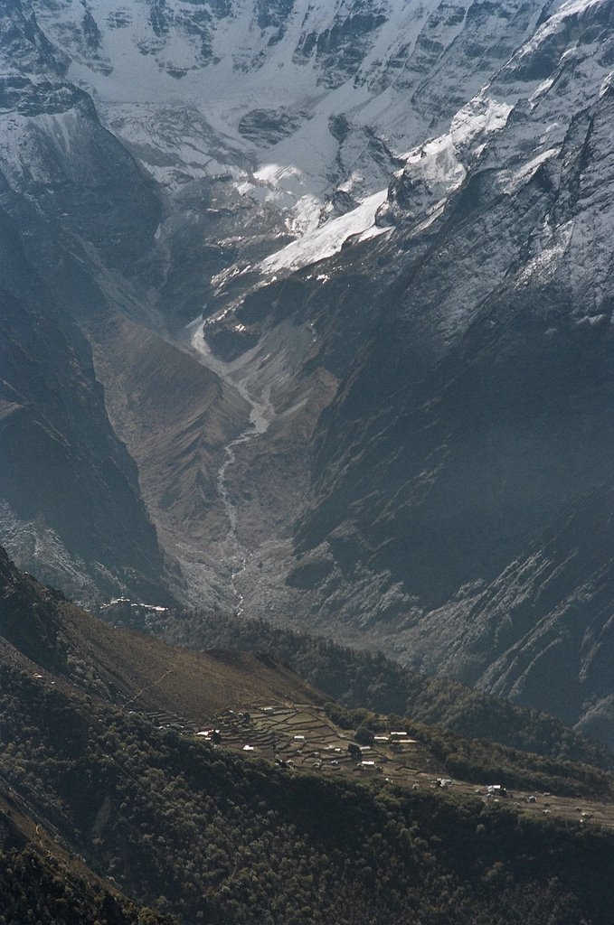
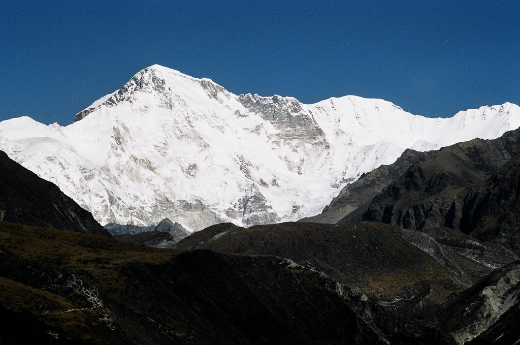
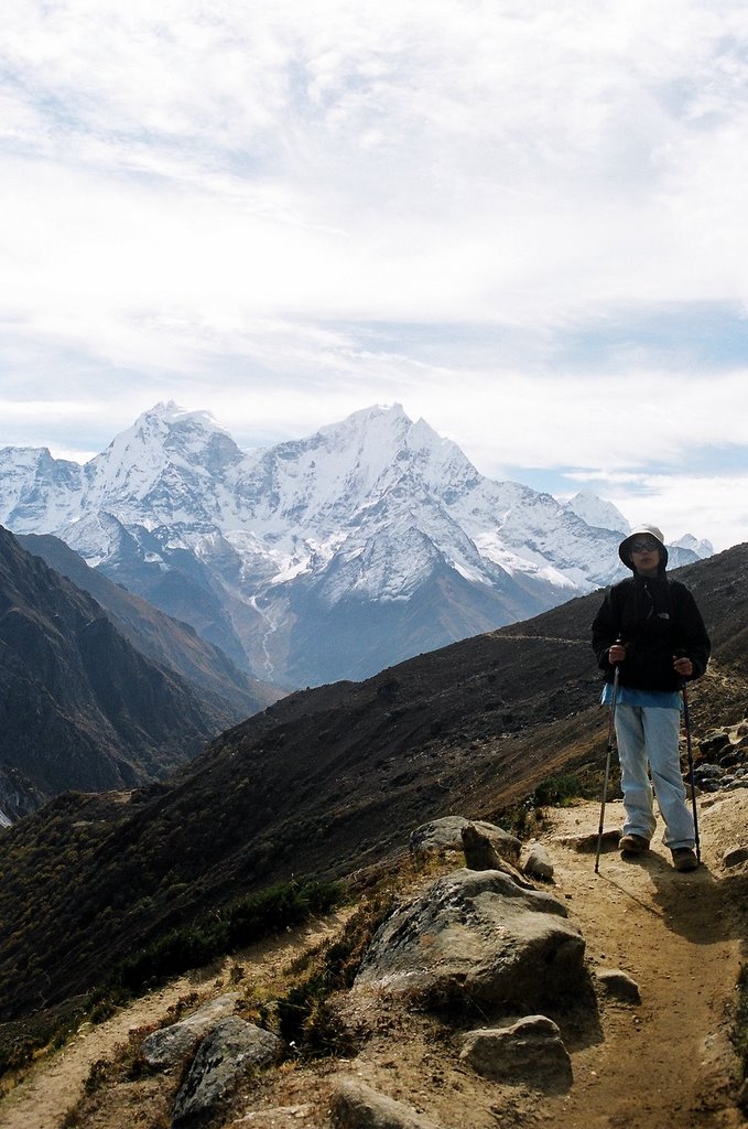
A few things. The space alloted for photographs do not do justice to the breathtaking views of the Everest region (neither do the photographs themselves), so click on the images to magnify them.
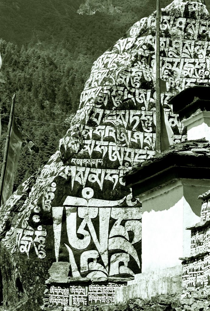
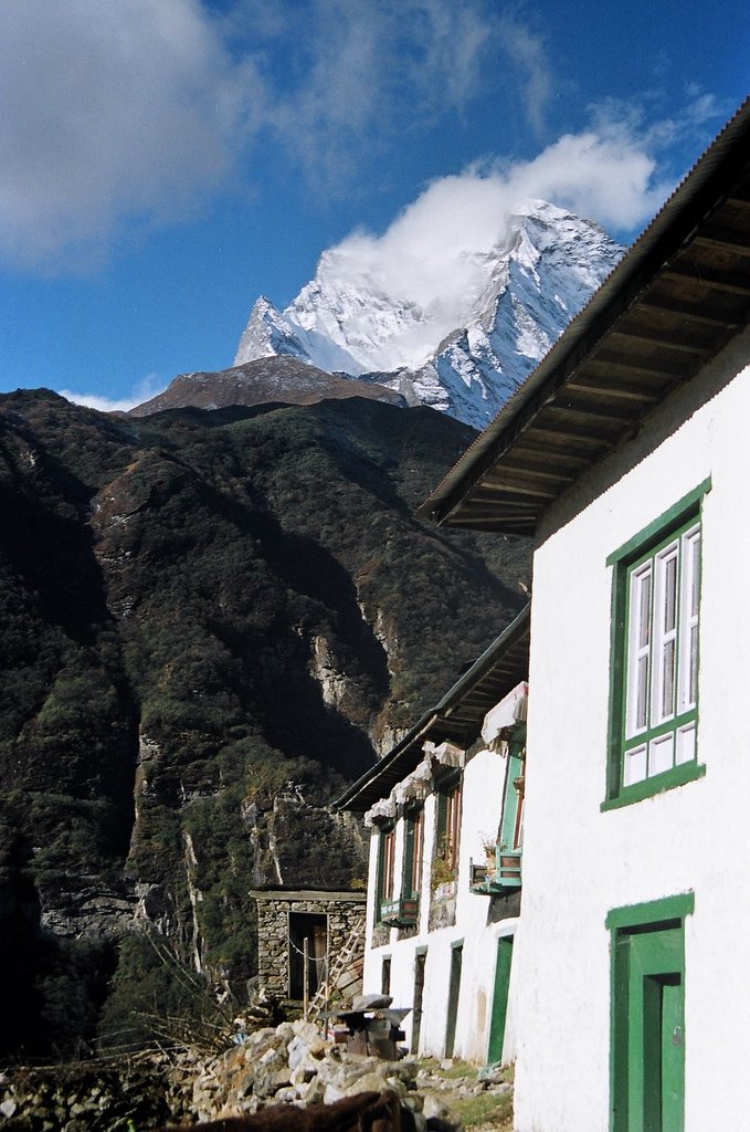
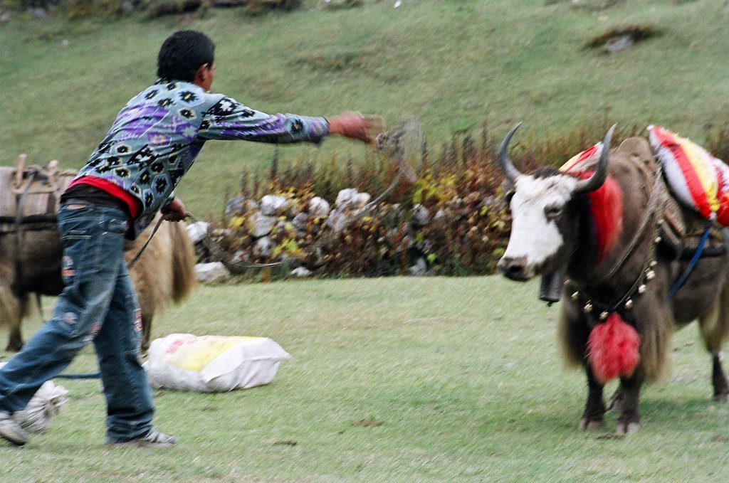
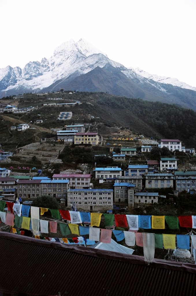
In this blog, I keep talking about Khumbhu, it refers to the higher Northern part of the Solukhumbhu region of Nepal where the Everest is located. Our trek entailed travelling through Khumbhu only, but in the old days, when mountaineers started their journey from Kathmandu, they had to walk through the Solu district as well, and would have had the opportunity to experience the wonderfully diverse terrain, cultures and ethnic groups of the middle Himalayas. Today, sadly, Solu is in the grip of a raging Maoist insurgency although I am confident it is, as is any other part of Nepal, safe for visitors.
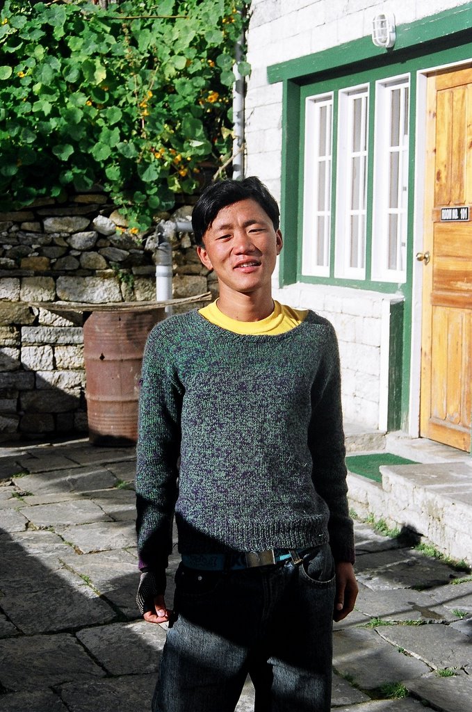
As I read this blog, I get a feeling that I have been a little harsh on our guide. He might have had his problems but he did try, in his own way, to ensure we saw everything he felt was worth seeing in the beautiful, brooding, majestic world that he inhabits. On our last day in Lukla, he came to see us off at the airport, and presented us two Sherpa scarves, which today, are draped over our bedroom mirror. They remind us that outside of office, deadlines, projects, bills, household chores and finances, there exists this other world. How often we choose to visit it depends on us alone.


Thursday, November 03, 2005

Kathmandu to Lukla, 9th October, 2005.

It's 4 p.m. and the departure lounge of the Kathmandu domestic airport is filled with delayed passengers. Outside, a wall of gray rain is pouring down onto the runway. The Pokhara-bound flight is cancelled. So is the one to Chitwan. We, on the other hand, don't even know if our flight exists. Our boarding pass shows no flight number, or destination. We wait.
We were supposed to be flying the day before, but due to iffy weather in Lukla, there were no take-offs. In Nepali aviation parlance, in the high mountain areas of Khumbhu, "even the clouds have rocks." We are re-booked onto the 11:50 flight today, and arrive at the airport at 10 sharp. The domestic airport is in a state of glorious chaos. Mountains of gear are strewn around, each lot headed for a different climbing expedition. We navigate around a pile and arrive at the Yeti Air counter. They ask us to wait. We do. It's a long one but two years in Nepal has taught us patience. 11:50 comes and goes, and all our queries at the counter are met with a smile, and a "Please wait". Finally at about 12:30, the official looks at my ticket and says, "Oh, but your flight is gone! Boarding happened through the Skyline Airways counter." And how, pray tell, was I supposed to know that? He claims he looked for us everywhere. Everywhere that is, except across the counter. A senior Yeti Air official walks up and hears me out. "Don't worry sir, you will fly today", he assures me. A boarding card is printed out and we are checked in. "Uh, what time is the flight?" "When it comes", is the reply.
At about 4:15, the rain shows no signs of letting up and we are thinking of returning our boarding passes and demanding our money back, when a voice calls out for "passengers to Lukla". In this weather? "Oh yes sir, weather fine in Lukla."
We are bundled into a bus which drives us to the rain drenched runway. A tiny Twin Otter aircraft waits. Except for a couple of officials, we are the only passengers. Seats are pushed back to load consignments of trekking gear (and drums of kerosene!) that fill up the entire front half of the aircraft. The cockpit door remains open.
At 25 past four, we lift off from Kathmandu. The skies clear soon after we leave the valley and then we are inside the mountains. We look out of the window at the scenery outside as the wind shear from the hills buffets the aircraft about. Half an hour later, the plane shudders and drops sharply. It banks to the left, and appears to dive straight into the hill ahead. The co-pilot stifles a yawn. At the last possible moment, we pull up, and a runway, inclined upwards at about a 20 degree angle appears beneath us. The tilt is to help decelerate the aircraft before it can overshoot the runway and fall down the other side. It feels like landing on Dhakuria Bridge. We touch down, the impact rattling the cabin and spilling some kerosene, and roar to a stop. A large sign says "Welcome to Lukla. Long live our King and Queen."
Apa, our contact in Lukla, and three-time Everest summiteer, meets us on the runway. "So you are finally here", he says, shaking our hands, and bundles us off to his hotel, Numbur, for a warm meal.

Lukla to Monjo

We meet Lakpa, our guide in the morning. He’s a quiet, rather taciturn man, and most of our questions are met with monosyllabic replies. He’s arranged a porter for us who’ll meet us at Monjo.
It’s a pleasant walk from Lukla, following a downhill trail along the banks of the Dudh Koshi river. Soon we encounter our first yak train. Only, these are not the real thing, which are only found above 3500m, but dzopkyos, a cross between yaks and the lowly plains cow. Incidentally, a yak is male, the female is a nak, so technically, all the yak cheese selling in Kathmandu is actually nak cheese.
An hour and a half from Lukla, we catch our first glimpse of Mt. Khumbhila, patron God of the Khumbhu Valley. Soon, we are at the Sherpa Villge Guest House at Phakding, where we stop for lunch. From there, it’s a three hour climb to Monjo.

Intricately carved giant mani stones dot the trail from Phakding to Monjo.
We stop for the night at Top Hill Guest House, Monjo. There, on the hotel yard, I meet our porter, Jamal Singh, a 19 year old Rai (a middle hills tribe) boy with a shy smile. Jamal comes from a village below Lukla, two days’ walk away, but he usually manages in a single long day, he tells me. In the off season, he works in Sherpa households in Lukla. His mother lives alone in the village, working in the fields. They had two cows which they had to sell off, so now they are a little hard up. In his spare time, he takes a battered English text book out of his pocket and brushes up his lessons. Jamal quit school at 12, and doesn’t believe he’ll ever go back.

Jamal. Posing.
I decide to stay outside for a bit and have a smoke. “Namaste”, a tall Australian trekker with a large red beard sits down next to me and starts to roll himself a cigarette. Smokers, alone in this world of fitness-conscious trekkers and strictly-no-smoking dining halls, we immediately bond. We don’t ask each other our names, so in my mind I keep referring to him as The Man with the Red Beard, Redbeard for short, although there is nothing buccaneer-like about his soft voice, his kind, twinkling eyes and his genuinely gentle demeanour. He is from Adelaide, on a 20-day trip to Nepal with some friends, after which he is flying to India for a week. Right now, they are on their way to Gokyo, like us, after which they plan to continue to Everest Base Camp. “It all depends on how we feel up there, I am not into goals, you know”, he tells me, “I am happy to see the mountains from a distance, I am just happy to be here. At peace.” We have a long conversation, chatting about many things, from Nepali politics to cricket and George W Bush.
Later, Kajori and I walk down to the Sagarmatha National Park Entrance and pay our park permit fee in advance.

Monjo to Namche Bazaar

When we awake, it’s a clear day, and right behind the lodge, where there was a gray sky last afternoon, stands a snow peak. The trail descends from Monjo to the Dudh Koshi basin and then climbs a series of steps to the first of the many suspension bridges across the river.

Trekkers cross a swaying suspension bridge over the Dudh Koshi river (below).

We cross over to the markets of Jorsale, and after a series of switchbacks through dense forests arrive at a 120m bridge hanging at a dizzying height (see picture) over the confluence of the Bhote Koshi and Dudh Koshi rivers.
We step onto the bridge, followed closely by a herd of dzopkyos. The bridge brings us to the final haul to Namche Bazaar, a series of endless switchbacks heading up, up and up. We have been warned about this stretch and embark on it with some degree of trepidation. It’s not that bad.
I regain my rhythm after the fourth switchback or so, Kajori stays half a switchback ahead, and Lakpa further on. He has a tendency to hurry on without looking back, and many a time, I ascend a trail to find him waiting impatiently, looking at his watch. We discover later that he has a drinking problem, and all this hurry is in order to reach a teahouse early enough for his morning tipple.
After about an hour’s climb, Lakpa beckons us to the edge and there, through the trees, we catch our first glimpse of Everest.

The Big E.

Namche Bazaar (3440m)

We reach the gates of Namche at about 11 and I feel weak at the knees. This is it. Namche Bazaar. Sherpatown, mountaineering capital of the world, place of legend. Every year, 20,000 trekkers make this pilgrimage, retracing the steps of the world’s last great explorers. This is hallowed ground, legend lies beyond its gates.

The gates of Namche.
In front of us, the town sprawls in a giant horseshoe across three hills. The great peaks of Kwang De and Thamserku form a fitting backdrop to this hometown of the world’s most prolific climbing community.


We skirt the main town, pass a chorten and climb to the Western ridge. Namche is highly developed, getting its electricity from its very own hydro-project in Thame. There are telephone lines, VSAT connections and Internet. The hospital a short distance away in Khunde is well-equipped. The Hillary Foundation run school in nearby Khumjung rivals the best schools in Kathmandu in terms of the quality of education provided. In terms of scenery, it has no competition.


Everest Hotel on the Western ridge, run by the very courteous and very busy Dil Magar Thapa, is to be our base for the next two days. There are no private rooms available today and we are put up in the dormitory next to the dining hall. A very welcome hot shower (Rs. 150) and a large bowl of Shakpa (Sherpa stew) later, we head out to explore the town.
Lakpa takes us down to the main street, past Western Union Money Transfer outlets, cafes, German Bakeries, pubs, and numerous shops selling trekking gear, beads, prayer wheels and curios. Tibetan traders crowd the street corners, dusty, lined and weather-beaten from their long, hard journey across centuries-old trade routes over the high mountain passes between Tibet and Nepal. The yaks from their caravans wait despondently, occasionally creating the world’s highest traffic snarls at 3440m.
We visit an Internet café (240 rupees a minute) to send off a couple of quick emails to our families. Down the street, Hermann’s Bakery Café sells the nicest muffins with great cappuccino to wash them down with.

Khampa traders from Tibet.
Later, we walk down to the Tibetan Market to witness yet another triumph of Chinese capitalism. Instead of the traditional cargo of salt, wool and handicraft, the ancient yak caravans are laden with cheap Chinese radios, fake Timberlands and imitation North Face jackets. Disillusioned, we retire to the comforts of Everest Hotel where in lieu of real lemon tea, Dil Magar Thapa whips us up two quick mugs of heated Foster Clarks lime drink (25% of your daily requirement of Vitamin C).

Trekking around Namche: Acclimatization Day

We don’t get much sleep in the dorm that night. Till about 10, trekkers fill the dining hall, their laughter and conversation reaching us through the thin walls of the dorm. Then the porters take over, opening their raksi bottles and the night grows raucous. Once they retire, Dil takes over, cleaning up and noisily moving the furniture around.
In the morning when I get up, bleary-eyed, to brush my teeth, Dil throws me an apologetic glance. “Private rooms today”, he promises. We get a nice room on the first floor, spotlessly clean, with wood furnishing and the sun streaming in through two large windows. It’s 8 when we leave for our acclimatization walk.

We circle the hotel to arrive at a trail ascending out of Namche. We pass a chorten, rotating the prayer wheels as we go while Kwang De’s dazzling vista towers benignly over us.

The ridge above Namche is bare but for scrub. Over us, Khumbhila, the holy mountain of the Sherpas stands tall and dark. Atop the ridge, one of the Syangboche airstrip buildings can be seen.
Halfway up the ridge, we get a bird’s eye view of Namche. A lot of construction is visible, the sprawl threatening to spill over the three ridges enclosing the town into the valleys beyond. Lakpa remembers a time when Namche had thirty houses. Now, it’s close to ten times the number of buildings, most of them hotels, to accommodate the growing tourist pressure on the region.

Namche from top.
It’s nine in the morning when we are standing on top of the ridge, on the Syangboche airstrip. Originally built to service the ill-fated, Japanese-built Everest View Hotel, the airstrip is really a large flattish meadow bounded by Thamserku on one side and Khumbhila on the other. On the far side, a lone pony grazes.


The airstrip.
A short walk later, the trail divides into three. We take the one on the right hand side which soon levels out to a pleasant walk through a wooded area. We emerge out of the woods on an exposed ledge with a magnificent view of the Everest, Lhotse and Ama Dablam’s distinctive thumb-like summit. It’s clear enough for Lakpa to point out the Hillary step, just over the South Col. The altitude is 4050m and we feel great.

Everest and Lhotse from Syangboche. The blur on the summits is from snow that is being blown off the peaks by constant, hurricane-strength winds.

Chomolungma, Mother Goddess of the Earth. The peak to the left is the main Everest summit. The ones on the right comprise the Lhotse face. The slight bump just below and to the right of the tip of the main summit is the Hillary Step, the last hurdle before the summit, where traffic jams occur during peak mountaineering season.

Up from Syangboche.

The trail turns a bend and we come to an alpine pasture. Herds of wild yak graze. Everest provides a stunning backdrop. Here, a wild yak in an unusually pensive mood.

A short distance away from Syangboche, lies the infamous Everest View Hotel, where we stop for an extravagant cup of tea.
The stunning Hotel Everest View was built in 1968 to attract wealthy, middle-aged Japanese tourists and was entered in the Guinness Book of Records in 1999 as the world’s highest luxury hotel, at 3964m (13,000 feet).
The idea was to transport guests directly from Kathmandu by helicopter into the Syangboche airstrip, and then to the the hotel from where they could, at US$275 a night, enjoy one of the finest views in the world from the luxury of its Japanese style patio.
Guests flew in, in droves, only to keel over the following morning from altitude sickness. After a couple of deaths, the airstrip was practically abandoned. This spelt disaster for the hotel, because its clientele weren't the kind to endure the hard, three-day trek up to Namche. Today, most tourists at the hotel are like us, trekkers, merely dropping in for a cup of tea in the course of their acclimatization walks.
One would think this would be lesson enough for hoteliers not to treat the Khumbhu region like your average beach resort, but construction of a five star hotel has once again begun on the ridge opposite Namche, practically on the edge of the Kwang De summit.

At the patio of the Everest View Hotel, one of the finest views in the world. From left to right, Mt. Khumbila, Everest, Lhotse, me, Kajori and Ama Dablam.

Kajori and Lhotse.
Later, we leave the Everest View Hotel and descend towards a large flat valley and the sprawling township of Khumjung. White cottages with green tin roofs dot the barren landscape. To the West, rises Ama Dablam.

Yaks graze outside the Khumjung Monastery.
The Khumjung Gompa is famous for a yeti scalp it houses inside a glass donation box in the main chamber . A framed write-up tells the story.
A long, long time ago, before the advent of Buddhism in the region, the people of Khumjung, Thame and Khunde met in Thame for a festival. At the end of the festivities, the people of Khumjung were handed the yeti scalp as a parting present. The Khumjungites were expecting a more valuable gift, and in their anger, kicked it around all the way back to their village. It was only later in the 1950s, that the scientific community took interest in the relic.
What the write-up does not go on to mention however, is that in 1960, a team led by Hillary and Desmond Doig took the skull to the US for tests and found it a fake. Spoilsports! Still, I part with a hundred rupees to look at it. It might not be of any value as a biological specimen, but it’s perfectly authentic as a piece of mythology, and after all, mythology is what we are in search of, here in the shadow of the Everest.
We are back in Namche by 12. In the afternoon, as we sit by our window, reading, a Himalayan Tahr comes grazing at the vegetable patch outside. A while later, a male Impeyan Pheasant flashes by, its bright blue plumage startling against the fading browns of the evening.

The tahr that came visiting, note the national park tags on its ears.
In the evening, we run into Redbeard and friends. They are leaving Namche tomorrow, to go up to Phortse Thanga, so they'll be a day ahead of us from now on.
Later, we sit at The Pumpernickel having coffee and doughnuts. A European group opposite digs into their Weiner Schnitzels. “Hey aqualung”, growls Ian Anderson from the pub next door. Crowds gather around pool tables. It strikes me that in our two days in Namche, we have seen little of real Sherpa life. The sights, the sounds and the tastes are all foreign, geared to help 20,000 tourists feel at home. I’d like to come here in the monsoons, I think, when there are no trekkers, when the Sherpas finally come out and claim their town for their own.

The bright lights of Namche.

The second leg: Namche Bazaar to Mong, 14th October, 2005.

We say our goodbyes to Dil, who promises us a big discount on the return leg and hands me a card with his photo on it. Across town on the Eastern ridge, we join the trail leading to the high country.

The chorten to the memory of Tenzing Norgay stands as the last outpost to Namche. It’s a clear day, and Everest and Lhotse tower over us all morning.

This part of the walk provides many opportunities for wildlife watching for the patient, the silent or like us, the plain lucky. Here, a musk deer grazes in the slopes below Namche.

The trail to Gokyo.
About an hour away, lies Sanasa, where we stop for some tea. A couple of shops sell Tibetan curios, made in Kathmandu and usually available at Thamel at half the price.

After Sanasa, the trail to Tengboche and Everest Base Camp winds away towards Phortse. We take the higher, less travelled trail to Gokyo, walking through pine forests, catching the occasional glimpse of Tengboche, nestled on its magnificent perch under Ama Dablam. We reach Mong at noon.

Sunday, October 30, 2005

Mong


Mong (3900m), is where we stop for the night. Incredible views of Ama Dablam and our first encounter with the compost heap toilet -- a heap of dry or rotten leaves and a broom next to a hole in the floor. Once you are done, simply shovel the leaves over the evidence.

Mong is said to be the birthplace of Lama Sange Dorje, the reincarnate lama of Rongbuk Monastery in Tibet who’s said to have brought Buddhism into the Khumbhu. The chorten to the lama’s memory rises imposingly on the hilltop. Mt. Ama Dablam can be seen in the background.

The icy fins of Thamserku, from Mong.

Located on top of an exposed ridge, Mong is constantly buffeted by gale-strength winds. Clouds blow in and out at incredible speed. Here, Thamserku, minutes after the previous photograph was taken.

Ama Dablam from Mong.

Ama Dablam at sunset.

Thamserku in the moonlight.

Mong to Dole

From Mong, it’s a steep descent down sandy switchbacks to Phortse Thanga (3600m) on the banks of Bhote Koshi. From hereon, it’s a steady climb all the way to Dole, our next night halt. Although the trail is steep in places, it’s a lovely walk, through rhododendron and juniper forests bursting with fall colours and the forest floor golden with fallen leaves.

The forest at fall.

The tilted trees.

Looking back from the trail, down the valley, towards Phortse. The Bhote Koshi rages below.

Phortse from top of the trail. Mt. Kantega rises behind.
After about an hour's climb, we rest by a boulder under some prayer flags, while behind us, two waterfalls tumble down from the hillside. Shortly after, we meet our first Indian trekkers. Vishal from Patna is accompanying his friend down to Phortse Thanga. She fell sick from altitude in Machhermo, and cannot descend alone. “Wahaan scenery to jannat hai yaar,” he tells me, “but be careful. Lots of people are falling sick.” His friend gives us a wry smile, and then they disappear down the trail.

Lakpa and the falls.

A shepherd's hut just outside Dole.
We walk into Dole (4100m) at about 11:45 a.m. We halt for the night at the rather grandly named Alpine View Cottage. It turns out to be the only lodge in Dole without any electricity and hot water. Still, it’s empty, but for a couple of quiet Americans, and we look forward to practically having the whole place to ourselves. We sit on a bench outside next to a meadow with a view of Mt. Kantega, and wolf down our lunch.

View of Mt. Kantega from Alpine View Cottage, Dole.
Our hopes of having the lodge to ourselves are dashed as a large group of Germans troop in around 3 o' clock. They immediately take over the whole place, filling up every inch of space on the corridor with mountains of gear and using the dining hall as a changing room. The two Americans watch with hunted eyes from their corner, and we escape outside, only to find other invaders there.
A herd of yaks has been put out to graze in the pasture in front of the lodge. They are lording it out, giving hostile looks at whoever ventures out. After about half an hour when the herdsman comes to round them up, he meets with stiff resistance. When no amount of coaxing works, he lassoes, tethers and harnesses them one by one.

The Great Himalayan Rodeo.
When it's evening, we walk down the ridge to the river. It's getting cold already, so we head back after half an hour, but not before we have stopped to draw a few yeti footprints on the sandy banks. Dinner is rather dismal by candlelight, and we call it an early night. I have to get up a few times in the night to visit the loo, outside the building across a pasture. The clear moonlight creates weird pools of light and shade on the grass and it's easy to imagine large shaggy shapes lurking behind every boulder. I am not the only person whose bodily fuctions the altitude is affecting, and I lie awake for a long time listening to the Germans next door padding heavily up and down the corridor on their way to and from the toilet.

From Dole to Machhermo

We leave Dole early, descending to the river by about 8 a.m. to begin the long, steep climb up the ridge. A large group of trekkers are already on the trail, making their way up at a leisurely pace. It's a rather diverse group. A few people in their twenties are in the lead and the rear is brought up by a jovial group of retired Englishmen who stop to chat with everyone - us, their group members, guides and porters. Everyone walks at their own pace, and there is a lot of laughter, banter and conversation. After a week of goal-oriented trekkers, they are a pleasure to walk with. But soon Lakpa races ahead, impatient, and we have to follow, albeit not at his blistering pace. Halfway up the ridge, we run into the group's guide, a tall Australian. "That gentleman your guide? He's putting you through a good pace!", he exclaims as we pass him. He falls in beside us and strikes up a conversation. We learn his name is Chris, and this is his 19th trek in Nepal. Chris has trekked in India, and has lived in Calcutta for a while. He had a great time in Calcutta watching cricket matches, going to the races and pubbing. He finds it a fascinoiting city, he says, and laments that it hasn't been publicoised well enough. As we walk together, chatting, I discover that we are not out of breath any more, and the walk has suddenly become comfortable. Chris has set us our perfect pace. He falls back after a while to be with the older members of his group, with a cheerful "Take it easy".
Mt. Cho Oyu from the ridge atop Dole.


We stop at a charming little lodge at Labarma for tea. We find real hot lemon and not heated Foster Clarks, magnificent views (see picture) and... A! Real! Western! Toilet!