Sunday, October 30, 2005

Mong


Mong (3900m), is where we stop for the night. Incredible views of Ama Dablam and our first encounter with the compost heap toilet -- a heap of dry or rotten leaves and a broom next to a hole in the floor. Once you are done, simply shovel the leaves over the evidence.

Mong is said to be the birthplace of Lama Sange Dorje, the reincarnate lama of Rongbuk Monastery in Tibet who’s said to have brought Buddhism into the Khumbhu. The chorten to the lama’s memory rises imposingly on the hilltop. Mt. Ama Dablam can be seen in the background.

The icy fins of Thamserku, from Mong.

Located on top of an exposed ridge, Mong is constantly buffeted by gale-strength winds. Clouds blow in and out at incredible speed. Here, Thamserku, minutes after the previous photograph was taken.

Ama Dablam from Mong.

Ama Dablam at sunset.

Thamserku in the moonlight.

Mong to Dole

From Mong, it’s a steep descent down sandy switchbacks to Phortse Thanga (3600m) on the banks of Bhote Koshi. From hereon, it’s a steady climb all the way to Dole, our next night halt. Although the trail is steep in places, it’s a lovely walk, through rhododendron and juniper forests bursting with fall colours and the forest floor golden with fallen leaves.

The forest at fall.

The tilted trees.

Looking back from the trail, down the valley, towards Phortse. The Bhote Koshi rages below.

Phortse from top of the trail. Mt. Kantega rises behind.
After about an hour's climb, we rest by a boulder under some prayer flags, while behind us, two waterfalls tumble down from the hillside. Shortly after, we meet our first Indian trekkers. Vishal from Patna is accompanying his friend down to Phortse Thanga. She fell sick from altitude in Machhermo, and cannot descend alone. “Wahaan scenery to jannat hai yaar,” he tells me, “but be careful. Lots of people are falling sick.” His friend gives us a wry smile, and then they disappear down the trail.

Lakpa and the falls.

A shepherd's hut just outside Dole.
We walk into Dole (4100m) at about 11:45 a.m. We halt for the night at the rather grandly named Alpine View Cottage. It turns out to be the only lodge in Dole without any electricity and hot water. Still, it’s empty, but for a couple of quiet Americans, and we look forward to practically having the whole place to ourselves. We sit on a bench outside next to a meadow with a view of Mt. Kantega, and wolf down our lunch.

View of Mt. Kantega from Alpine View Cottage, Dole.
Our hopes of having the lodge to ourselves are dashed as a large group of Germans troop in around 3 o' clock. They immediately take over the whole place, filling up every inch of space on the corridor with mountains of gear and using the dining hall as a changing room. The two Americans watch with hunted eyes from their corner, and we escape outside, only to find other invaders there.
A herd of yaks has been put out to graze in the pasture in front of the lodge. They are lording it out, giving hostile looks at whoever ventures out. After about half an hour when the herdsman comes to round them up, he meets with stiff resistance. When no amount of coaxing works, he lassoes, tethers and harnesses them one by one.

The Great Himalayan Rodeo.
When it's evening, we walk down the ridge to the river. It's getting cold already, so we head back after half an hour, but not before we have stopped to draw a few yeti footprints on the sandy banks. Dinner is rather dismal by candlelight, and we call it an early night. I have to get up a few times in the night to visit the loo, outside the building across a pasture. The clear moonlight creates weird pools of light and shade on the grass and it's easy to imagine large shaggy shapes lurking behind every boulder. I am not the only person whose bodily fuctions the altitude is affecting, and I lie awake for a long time listening to the Germans next door padding heavily up and down the corridor on their way to and from the toilet.

From Dole to Machhermo

We leave Dole early, descending to the river by about 8 a.m. to begin the long, steep climb up the ridge. A large group of trekkers are already on the trail, making their way up at a leisurely pace. It's a rather diverse group. A few people in their twenties are in the lead and the rear is brought up by a jovial group of retired Englishmen who stop to chat with everyone - us, their group members, guides and porters. Everyone walks at their own pace, and there is a lot of laughter, banter and conversation. After a week of goal-oriented trekkers, they are a pleasure to walk with. But soon Lakpa races ahead, impatient, and we have to follow, albeit not at his blistering pace. Halfway up the ridge, we run into the group's guide, a tall Australian. "That gentleman your guide? He's putting you through a good pace!", he exclaims as we pass him. He falls in beside us and strikes up a conversation. We learn his name is Chris, and this is his 19th trek in Nepal. Chris has trekked in India, and has lived in Calcutta for a while. He had a great time in Calcutta watching cricket matches, going to the races and pubbing. He finds it a fascinoiting city, he says, and laments that it hasn't been publicoised well enough. As we walk together, chatting, I discover that we are not out of breath any more, and the walk has suddenly become comfortable. Chris has set us our perfect pace. He falls back after a while to be with the older members of his group, with a cheerful "Take it easy".
Mt. Cho Oyu from the ridge atop Dole.


We stop at a charming little lodge at Labarma for tea. We find real hot lemon and not heated Foster Clarks, magnificent views (see picture) and... A! Real! Western! Toilet!

Saturday, October 29, 2005


The trail winds towards Machhermo from Labarma. Today, we are walking well above the treeline, and the forested trail from yesterday has been replaced by an exposed, sandy path winding through bare rock and the occasional scrub juniper or dwarf rhododendron. Here there is no escape from the wind which constantly blows dust in our faces all through the walk.
At Luza, the last stop
before Machhermo.

Before negotiating the final climb to Machhermo, a porter rests his load to let a yak caravan pass. Yaks remind me of large, shaggy, generally good natured, sometimes unpredictable dogs attached with large, pointy horns. Yaks always, always have right of way.

Mt. Cho Oyu stands guard as we
skirt a chorten before
descending into Machhermo.

In yeti country

It was in Machhermo in 1974 that a yeti killed three yaks and attacked a sherpa woman. This is the most credible yeti incident ever reported in the Khumbhu, so be watchful as you visit this region.

- Lonely Planet Trekking in the Nepal Himalaya

The wild, wild country of Machhermo (4500m). The red building is Tashi Dele Lodge, which is to be our home for the next two days.

Kajori and Machhermo.

View from the lodge.

The Machhermo Valley. The flat area between the two hills is where the yeti attack took place. Personally, I am ambivalent about the whole yeti thing, but the sherpas do believe. As darkness gathers outside in the high altitude areas of khumbhu, voices drop and knowing looks are exchanged at the mention of the mythical creature.

View from the Tashi Dele Lodge.

Friday, October 28, 2005

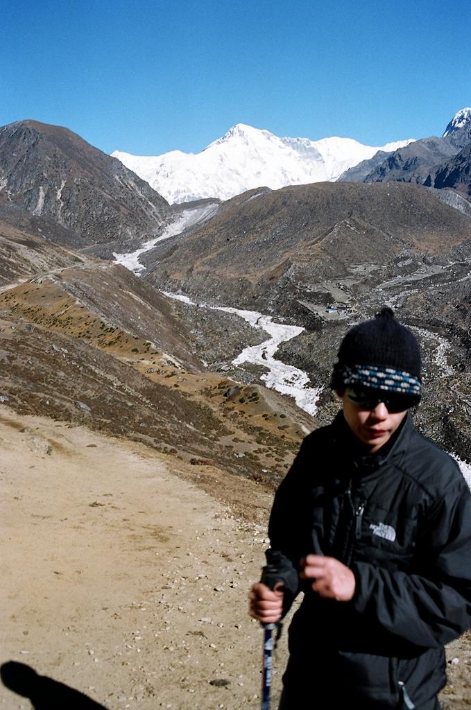
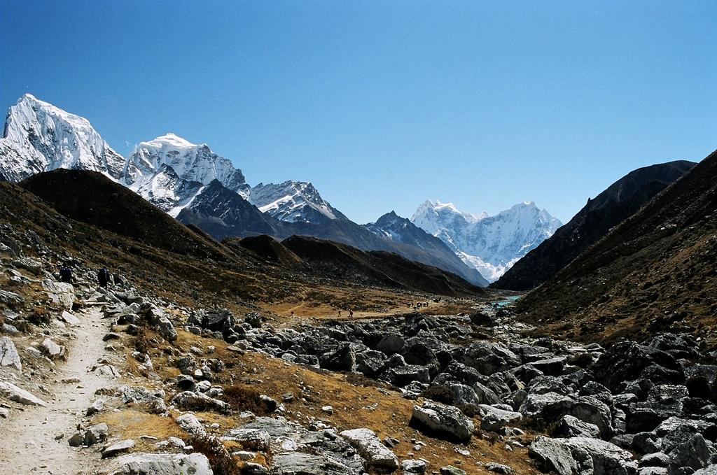
After lunch, we make our way down to the river. By the log bridge leading to the Northern ridge, we run into a man dressed in black leather trousers, a black jacket, high boots and a fedora. "Hi, I am Dr. Nick Mason," he says with a smile. Dr. Mason is British, this season's volunteer doctor-in-residence at the Machhermo Rescue Post just opposite. He is delivering a lecture on altitude sickness for trekkers at 3 p.m. today, and if we weren't doing anything, could we attend.
We take a short walk down the river to the yeti attack site. Afterwards, we hike across to Namgyal Lodge for Dr. Mason's talk.
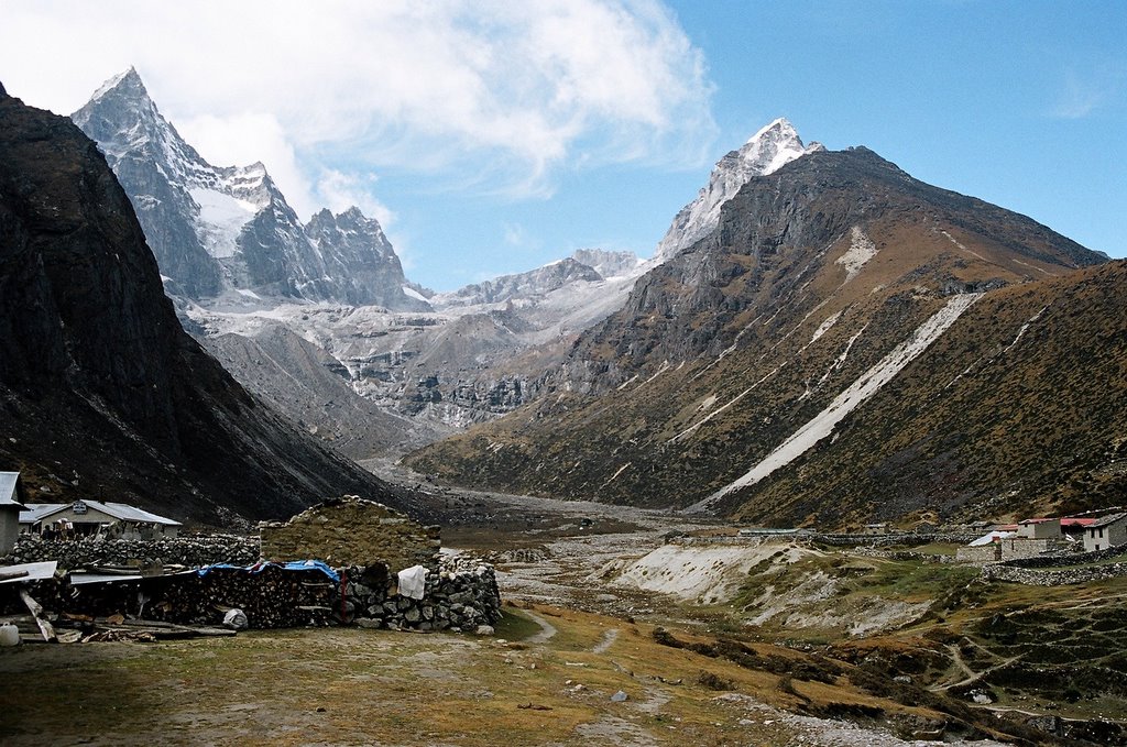
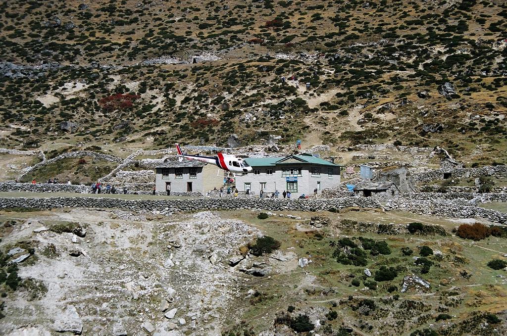
The Machhermo Rescue Post is affiliated to the International Porter Protection Group, and has been in operation since 2003. Run entirely by volunteer doctors-in-residence, aided by Chhewang Sherpa, manager, the post offers medical care primarily for porters, as well as for locals and trekkers who may have contracted altitude sickness and in extreme situations, even arranges rescues.
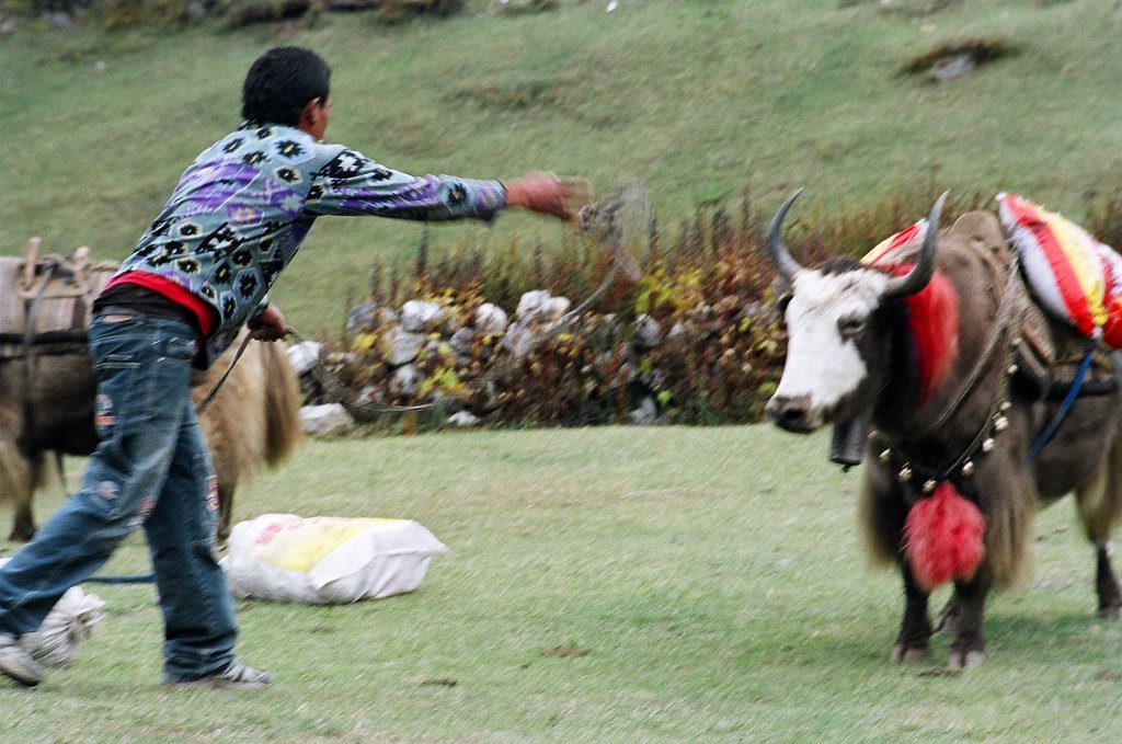
The day we arrived in Machhermo, a 22 year old Nepali porter lay dying on its Northern ridge. He had gone up to Gokyo with a Swiss group and developed AMS at 4800m. Not wanting to interrupt their trek, the group leader paid off his dues and told him descend. Alone. He collapsed a little way from Machhermo. A group of British trekkers, a few of them doctors, found him unconscious by the trail, and got their Sherpa to carry him into the rescue post. His condition was critical. The Machhermo Rescue Post deals with cases such as these practically every day.
Apart from running the clinic, the rescue post is also in the process of building a shelter for porters in Machhermo where, as in some other high altitude areas of Nepal, porters have to sometimes spend nights in exposed caves due to lack of space in the lodges. The organisation needs donations, and you can see a full account of the good work they do at http://www.ippg.net/


A short digression on altitude sickness: read this!

Who should read this? Anyone who feels like attempting this trek, or indeed any trek above 4000m, at some point of time(which probably includes some of you to whom this link was sent). Here's a statistic. More than 60% trekkers in the Everest Region suffer some form of altitude sickness. 37% get AMS, a more serious version. For about 13%, it takes a life-threatening form. There is only one cure for AMS. DESCEND!

Who's at risk? Most of all, people travelling in a group. The person feeling ill conceals symptoms to avoid holding back fellow-trekkers. Almost always. This behaviour is more common in all-male trekking groups. Secondly, the super-fit. AMS has nothing to do with fitness, smoking habits etc. How well a person adjusts to altitude depends on various factors, including genetics. Those who are fitter usually ascend faster, increasing the risks. Third, anyone. Even Sir Hillary could get it, at 3000m. Also, if you have ascended to 5000m safely on one trek, nothing prevents you from getting it at 2800m on your next.

Here's how it works. At 3500m, your lungs are taking in about 60% oxygen with every breath as compared to at sea level. At 4000m, you are down to 50%, i.e. your oxygen intake per breath is halved. At 5000, it's slightly over 40% and so on. To compensate, your body generates more red blood cells, and gets rid of fluids at a very high rate to increase your blood's haemoglobin concentration. So, if you have to get up to pee twice in the middle of the night, it's a sign your body is adapting. At -15 degrees, as you fumble for your sleeping bag zipper, it'll be hard to stay convinced that this is good for you. Your breathing will also become faster and deeper to compensate for the low oxygen content.

This is if everything goes well. If it doesn't, and you have a headache and/or nausea, dizziness, shortness of breath or insomnia that won't go away and gets worse with time, you are getting acute mountain sickness (AMS) and need to descend to the last altitude where you spent the night 
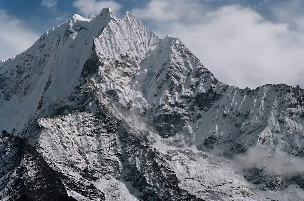
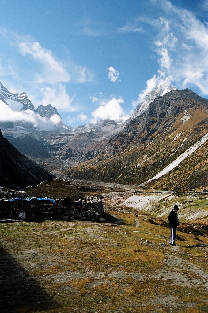
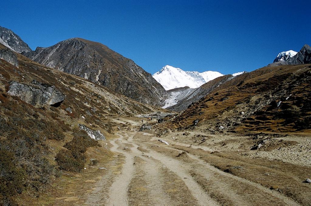
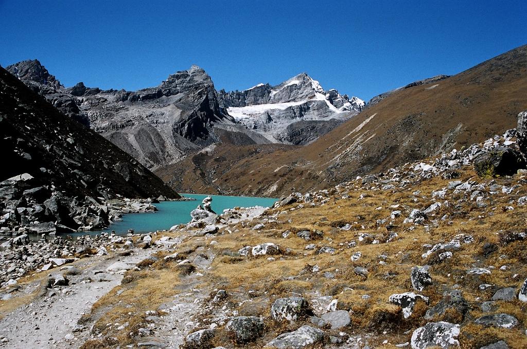
and felt well in the morning. Since AMS kicks in about 6-12 hours after you have crossed your personal acclimatization line, you might have to descend far to feel better. (What complicates things in the Himalayas is to descend, you often have to ascend first. The rescue post and the Himalayan Rescue Association call Machhermo The Death Valley. One has to walk miles before losing any altitude. The gentle, loping ascent which attracts trekkers to the Gokyo trail becomes their undoing if they get sick.)

The problem is, a certain amount of discomfort is normal at altitude. You may have a headache, slight exertion is supposed to leave you feeling out of breath, you might wake up in the night gasping for air (this used to happen to me over 4000m) because the low oxygen levels in the air have fooled your brain into thinking that there is no need to breathe... All this, believe it or not, is normal. As a result, it's easy to go into denial over one's symptoms.

Here are a few rules of thumb to go by. First, if you have these symptoms (Headache PLUS any of Fatigue/Drowsiness/Nausea/Vomiting/Loss of appetite/Dizziness/Irritability/Disturbed Sleep) DO NOT ascend. If with time, your symptoms disappear, you have acclimatized and can continue on your way. Second, with time, if your symptoms get worse, descend. Third, over 3500m, do not climb over 400m a day. Correction, you can climb more than that, but ensure you are not sleeping more than 400m higher than where you slept the night before. Fourth, put in at least one rest/acclimitization day for every thousand metres you climb. Fifth, drink lots of fluids. Sixth, if you do get sick, once you have descended, recovery will be dramatic. So in case you are wondering exactly how far you need to descend, the answer is descend till you start feeling better.

Left unattended, AMS can develop into its more serious forms, HAPE (High Altitude Pulmonary Edema) and HACE (High Altitude Cerebral Edema). Edema = water in the wrong place. For HAPE, it's in the pulmonary region i.e. the lungs, for HACE, it's in the brain. These are life-threatening. The afflicted person is in no shape to descend alone and must be descendED, either on the back of a yak, or carried by porters or by helicopter. HACE is a severe form of AMS where the patient will weave around as if drunk, and will not be able to walk in a straight line. He'll suffer from a severe headache, and may have any, none or all of the other symptoms. HAPE is more insidious and can strike anyone, anytime, even after 36 hours of acclimatization. The only symptom is you get out of breath after any exertion (which is exactly what you will get at high altitude) and when at rest for 10 minutes, your breathing doesn't return to normal. A sign for companions -- if, at rest, your friend does not seem to be able to finish a normal-length sentence in one breath, he's getting HAPE. DESCEND!

(If you found this scary, good. It's supposed to be. In our 5 days above 4000m, we saw 6 HAPE/HACE cases. I wouldn't want any of my friends to be so sick, so high up, and so far away from any kind of help.)
In the evening, we gather in the warmth of the dining room. The doctor drops in with some bad news. The condition of the porter has taken a turn for the worse. He has both HAPE and HACE and needs to be evacuated by tomorrow. The catch is, he is not insured and helicopter evacuation costs $3500. The trekking agency has been contacted but they have refused to pay. Could we help? Even a hundred rupees would do.
We can scrape together four hundred. The Scots across from us come up with $80. The Austrians next to us don't look up from their spaghetti and french fries. They don't speak English. We try to explain. Finally they say they do understand. Could they donate? No, they say with a derisive wave of the hand. They go back to their meal, and later, order beer. Outside the dining hall, their young Sherpa quietly stuffs five hundred-rupee notes into the doctor's hands.
After a while, the Austrians find the dining room frosty in spite of the hearth. They retire to their rooms. One of the Scots produces a birthday cake. Candles are blown out, the cake is cut, and we all get a slice. A birthday party at 4500m.

Thursday, October 27, 2005


We are up early the next morning. We have a quick breakfast, pack, and pay off the lodge, and by 8:15, we are on our way to Gokyo. Lakpa sets a brisk pace up the ridge, and soon we are at the chorten on top. From this vantage point the view down the valley towards Gokyo is terrific. Mt. Cho Oyu, the world's 6th highest peak, stands like a wall over the trail.
Shortly after crossing the ridge, Kajori complains of a headache. It started abruptly, she says, halfway up the ridge. I ask Lakpa what we should do. "You decide," he tells me. I decide to turn back. "Let's go up to Pangka", he says, "If madam feels ill we can come back." He hurries ahead to stop Jamaal Singh at the teahouse in case we decide to turn back. We make our way slowly up. Kajori's gait seems a little odd to me. So I make her take off her sunglasses to find she can't keep her eyes open. "Very sleepy," she mumbles. This is definitely Headache Plus. Without any delay, I bundle her down the ridge. At the halfway point, she seems to snap out of her drowsiness. We meet Chris' group. They are out for a short walk on the ridge. Chris wants to know if everything's okay, then nods knowingly. "Today, just sit back and enjoy the sun," he says. When they leave, I stop a Gokyo-bound porter to take a message up to Lakpa. By the time we ae back in Tashi Dele Lodge, Kajori is completely alert. Recovery, as the doctor promised, is dramatic.

Rescue!

We have nothing much to do for the rest of the day. Lakpa retires to the dining hall with a jug of chhang. We settle down in the yard with two glasses of lemon tea, chatting with Jamaal. Soon, we spot the rescue helicopter flying in from Kathmandu. It flies straight into the valley, makes a dizzying turn around the Machhermo Peak, and lands in the Machhermo Rescue Post yard across from us. A Japanese tourist boards and the helicopter takes off, to disappear towards Kathmandu. The rescue effort hasn't climbed down the food chain for the young porter yet. The helicopter returns for him an hour later. A young American who's just arrived finds all this amusing. He tells me, "See, that's how it is. Send one helicopter and everyone wants to go home." "Help me, help me, I am sick", he shouts, lurching down the hillside drunkenly, flailing his arms at the sky as the rescue chopper tries to make its precarious landing on the ledge opposite. Later, he takes out a wad of hundred-rupee notes from his pocket and hands it to the lodge-owner. He doesn't want to carry any small change over the Cho La pass, he says.


The rescue helicopter struggles to land on a precarious ledge on the Northern ridge of Machhermo.

In the afternoon, we go down to the stream to sun ourselves. The two retired British gentlemen from Chris' group are already there. They wave their hats at us cheerily from their boulder perch by the water.

Later, when we walk up to the Namgyal Lodge for some hot chocolate, Dr. Mason, his night's ordeal over, is busy conducting his 3:00 p.m. lecture for a new batch of trekkers.

Wednesday, October 26, 2005

The final haul

In the morning, Kajori is feeling better but says she does not feel up to the climb, and urges me to continue. It breaks my heart to leave her behind after having come so far. I decide to convert the trek to a day trip, and be back with her in the evening.
This means I have to abandon my plan to climb the Gokyo peak, but after having come this far, and having seen so many magnificent sights, it does not seem like a big thing to give up.
After a quick apple, Lakpa and I leave. It's seven a.m., the sun has just come up and the frost is leaving the rooftops in big, sparkling drops.

For the second time in two days, I climb up to the chorten on the Northern ridge of Machhermo.

From the ridge over Machhermo, the trail winds gently down to Pangka.
We stop at Pangka for some morning tea. It was at Pangka in 1995 that an avalanche completely wiped out a Japanese trekking group as they sat in their dining tent. The owner of the teahouse servicing the camp met with the same fate. Today two lodges have sprung up again, this time slightly away from the avalanche path. "Famous avalanche site", Lakpa points out the spot to me. Other guides do the same for their clients. Pictures are taken. The avalanche happened after some freak weather in the Bay of Bengal deposited a few extra metres of snow on the Nepal Himalayas. Lakpa himself was trapped with a trekking group in Manang for a week, depending on food packets airdropped by the Nepalese Army for sustenance. With time, even tragedy becomes a tourist attraction, and tales of woe and ordeal anecdotes, tossed casually around over a cup of lemon tea.

The trail to Gokyo, from Pangka.

Into Gokyo

About an hour from Pangka, the trail climbs sharply up, past a cave at Nilibuk. Although the gradient isn't as steep as what we have experienced before, I find the going difficult. Every time I stop it gets a little more difficult to catch my breath. And stop we do, frequently. I sense Lakpa growing impatient with me but I stubbornly stick to the pace set by Chris. The path seems to have no end. At the precise point when I am actually considering turning back, we arrive at a steep staircase trail. Above lies Gokyo. I walk slowly up the steps, sticking to Chris' group. They are walking at their usual leisurely pace, but today there is no talking and banter. Lakpa expresses his disapproval by bounding up the trail, laughing, but I will not be provoked. I promise myself that one day I'll fly him down to Delhi and have a road crossing competition at ITO but today, I will take things slow. I keep my eyes on the trail and climb, one step at a time.
A large hand grasps my shoulder and a red beard appears over the brim of my hat. "Namaste, everything okay?" Redbeard, his eyes twinkling. We shake hands warmly. "We are going to Phortse today. Then maybe we'll go up again to Kala Pattar", he says. "You are almost there," he adds in his soft, kind voice, "the views are fabulous." We bid each other goodbye, standing on that narrow steep staircase leading up to Gokyo, with the Bhote Koshi to the right of us, plunging down to the valley below in the form of a twin waterfall. Then we go our separate ways. "Be careful", says Redbeard, over the roar of the water. I feel comforted after our encounter and the rest of the stretch is not so hard. In this alien world of dust and rock and thin air, he represents the familiar, although I still don't know his name.
At the end of the trail, is a simple bridge. The terrain is more or less flat, and a short walk brings me within sight of the first lake.

Longponga, the first of the Gokyo Lakes


When I first set my eyes on the lake, I have to do a double take. The clear, still, dark blue waters of the lake appear illusory in this world of hard, uninterrupted gray-brown rock, boulder and stone. With a second glance, it fits in. This is no oasis, this is the sharp blue edge on the steel that is the soul of Khumbhu. Numerous cairns fashioned out of rocks and pebbles stand all around the lake like gravestones, making me feel that I am standing in the highest semetary in the world. I have to watch my step, for fear of upsetting a chorten, and inviting the wrath of a mountain spirit. There is no habitation here -- the only village is far away, by the more inviting green waters of the third lake.

A Sherpa erects a cairn at the banks of the first lake. These customs, including that of erecting prayer flags on hill-tops, are legacies of the animistic Bon religion of Tibet. They were later absorbed into Buddhism.

We follow the rough, relatively level trail till the second lake comes into view.

Taujun, the second lake at Gokyo


Cairns dot the banks of the second lake.

The trail climbing to the third lake winds away from the second, passing an impressive line-up of high peaks to the left of the picture -- Cholatse, Gyachung Kang and Kantega, among others.

Dudh Pokhari, the third lake


After an interminably long walk from the second lake, I come to a chorten marking the entrance to the Gokyo village.

Up on the ridge, on the bank of the third lake, lies Gokyo village. Mt. Cho Oyu towers behind the lodges.

I realize I am ravenous, a good sign in these altitudes, but before climbing up to the lodges above, I decide to spend some time beside Dudh Pokhari, the third lake.

Tuesday, October 25, 2005


I climb the trail up the village to the Gokyo Resort Lodge for breakfast. The views all around are tremendous.

The third lake as seen from the Gokyo Resort Lodge.

On to Tonak, Lake No. 4


As we leave the third lake behind, I stand on a ridge to look back upon it. Some of the village houses can be seen on the left. Our trail follows the stream for the first few minutes.
To get an idea of the sheer scale of the surroundings, click on the picture to magnify it and spot the yaks grazing by the stream. There are three.